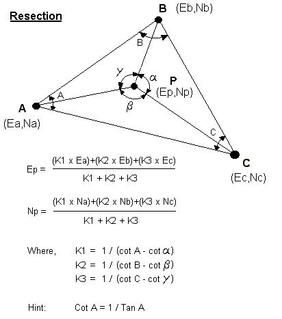
I came across this website from the University of Portsmith Department of Civil Engineering today that covering many of the details about engineering surveying: http://www.civl.port.ac.uk/survey/ The site includes a series of PowerPoint presentations on a variety of essential archaeological field skills (e.g., leveling, setting up a theodolite, theodolite errors, converting rectangular to polar coordinates, etc.). Of particular interest is a Java based "General Purpose Angular Resection Program." As anyone who has taken my Archaeological Field Research Design class will know, resectioning is the best way to establish the position of survey instrument, yet the calculations can be a pain. Having an applet to do this greatly reduces the chance for calculation blunders.
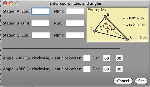
The applet works on Mac and Windows, though on Mac OS X the menus for the applet appear on the menu bar not in the the little applet windows (so user beware). Below is a little screen shot of the input screen for the applet.
If you don't like the applet version of this program, you might try this browser based version:
http://www.spatialreference.co.za/Resection.asp
or the cell phone version (iphone!):
http://www.spatialreference.co.za/cell_Index.asp
More resectioning information:
1 comment:
Ah man. "Three point resectioning" so THATS what it is called...
When I took your class I kept trying to look up "resectioning" and ended up with not many resources for equations.
Googling "three point resectioning" I found a powerpoint on the web at www.surv.ufl.edu/courses/wwwusers/sur2101fall04/LecResection.ppt that goes over the three possible combination of three points and the target in resectioning and I found it to be pretty useful.
Post a Comment