For those of you out there wondering how to take LiDAR data or DEMs and turn them into cool 3-D visualizations or to do some analyses on them, you might check out LandSerf.
LandSerf is a freely available Geographical Information System (GIS) for the visualisation and analysis of surfaces. Applications include visualisation of landscapes; geomorphological analysis; gaming development; GIS file conversion; map output; archaeological mapping and analysis; surface modelling and many others. It runs on any platform that supports the Java Runtime Environment (Windows, MacOSX, Unix, Linux etc.)
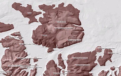
LandSerf seems to be able to open all kinds of vector and raster data and has a variety of great tools for analyses. One that I think will particularly useful in our study of Guatemala mangroves and for the Yazoo Basin is the "peak/pit" analysis (such as the example below of peaks in the English Lake district). Best of all its free!
No comments:
Post a Comment